Essential Rwanda Travel Tips
August 15, 2026
Cultural Festivals in Uganda
August 15, 2026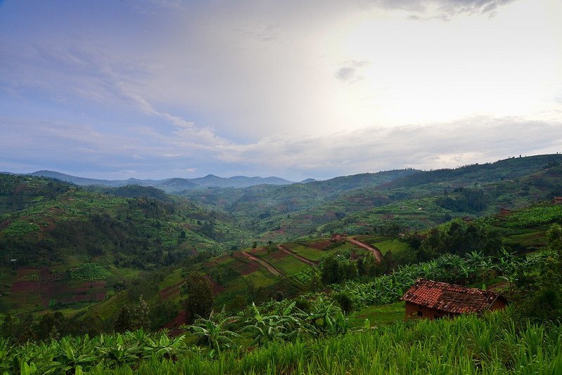
Rwanda welcomes every visitor with a landscape that folds and rolls in every direction, and that single visual trick is exactly why the world nicknamed it the Country of a Thousand Hills. Nestled in the heart of East Africa, this small nation covers only about 26,338 square kilometers, yet it packs volcanoes, rainforests, lakes, and savannah into that compact footprint. Travelers who arrive expecting a quiet stopover often leave describing Rwanda as one of the most visually striking places they have ever explored. At Zamunda Travels, we build itineraries around this exact reaction, because the terrain itself does most of the storytelling. This guide walks through the origin of the nickname, the geography behind it, and the destinations that make Rwanda the Country of a Thousand Hills worth every hour of the journey.
Why Rwanda Earned the Name Country of a Thousand Hills
Local Kinyarwanda speakers call their homeland “Urw’Imisozi Igihumbi,” which translates directly into “Country of a Thousand Hills.” Rwandans coined the phrase long before international tourism boards adopted it, and the description still holds up on the ground today. Interlocking ridges rise and fall across nearly every region, so a road trip through the countryside rarely runs flat for more than a few minutes.
The elevation swings dramatically too: Mount Karisimbi towers at 4,507 meters in the north, while the land drops to roughly 1,220 meters near the swampy Akagera river valley in the east. Zamunda Travels routes many of its self drive itineraries specifically to capture this contrast, because guests notice the shift in climate and scenery within a single afternoon.
Coffee farms, tea plantations, and terraced food gardens cling to the slopes, turning the hillsides into a patchwork of green that changes shade with the season. Ask any long term visitor why the Country of a Thousand Hills nickname persists, and they will usually point out the window rather than reach for a history book.
The Geography Behind Rwanda’s Rolling Terrain
A mountain chain runs along a north south axis through western Rwanda, forming part of what geographers call the Congo Nile Divide. This ridge separates the watersheds of two of Africa’s greatest river systems, sending some rainfall toward the Congo Basin and the rest toward the Nile. Volcanic activity shaped much of the northern landscape, and the Virunga Mountains still dominate the skyline near the border with Uganda and the Democratic Republic of Congo.
Mount Bisoke and Mount Muhabura rise alongside Karisimbi, and together they create the dramatic backdrop that photographers travel across continents to capture. Forests cover roughly a quarter of the national territory, spreading across national parks, natural woodland, and managed plantations. Because the hills trap moisture and funnel it into countless streams, Rwanda also supports a dense network of rivers that eventually feed into Lake Kivu along the western border.
Zamunda Travels often points first-time guests toward Mount Kigali, Mount Jari, and Mount Bumboga, three peaks that ring the capital and offer an accessible introduction to the terrain before a longer expedition begins.
Kigali: A Capital Built Across the Hills
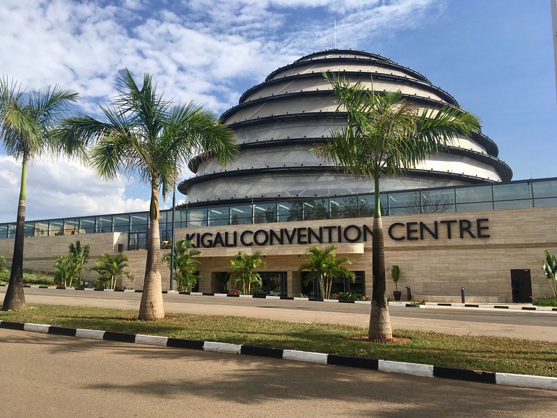
Kigali sits directly on top of this rippling landscape, so the city itself functions as a living demonstration of why Rwanda carries its famous nickname. Neighborhoods spill down hillsides in tiers, and a short walk between two districts can involve a genuine climb rather than a flat stroll. The city has also become one of Africa’s cleanest and safest capitals, thanks to strict environmental policies and a citywide ban on single use plastic bags.
Visitors regularly comment on how quiet and organized Kigali feels compared to other major African cities, and that reputation now draws international conferences, tech investment, and a growing hospitality scene. Zamunda Travels recommends at least one full day in Kigali before heading into the countryside, since the Kigali Genocide Memorial, the local craft markets, and the hillside restaurant scene all deserve unhurried attention.
From a rooftop bar in the Kiyovu district, guests can trace the silhouette of hill after hill stretching toward the horizon, and that single view often explains the Country of a Thousand Hills nickname better than any guidebook paragraph could.
Volcanoes National Park and the Mountain Gorillas
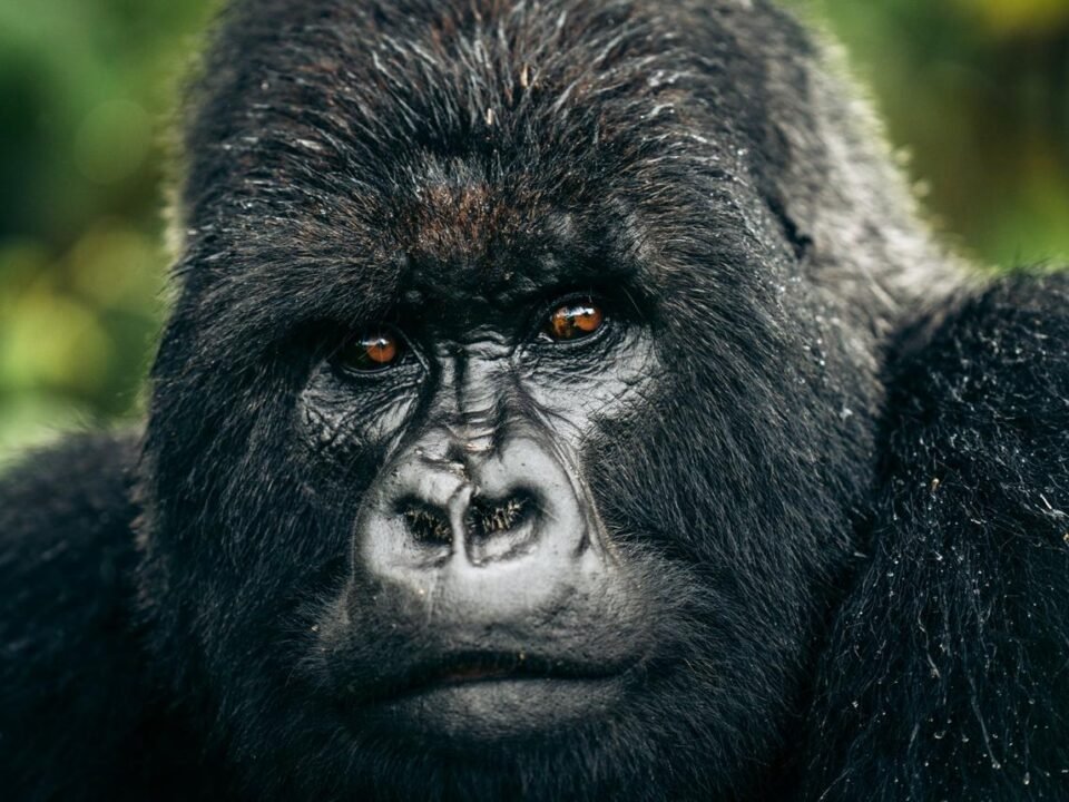
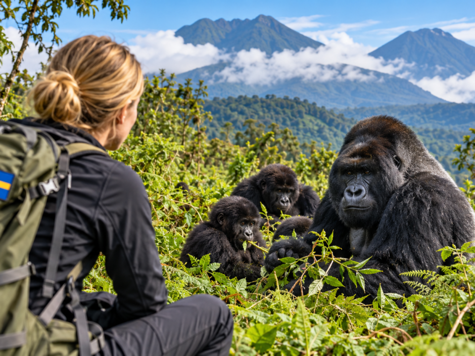
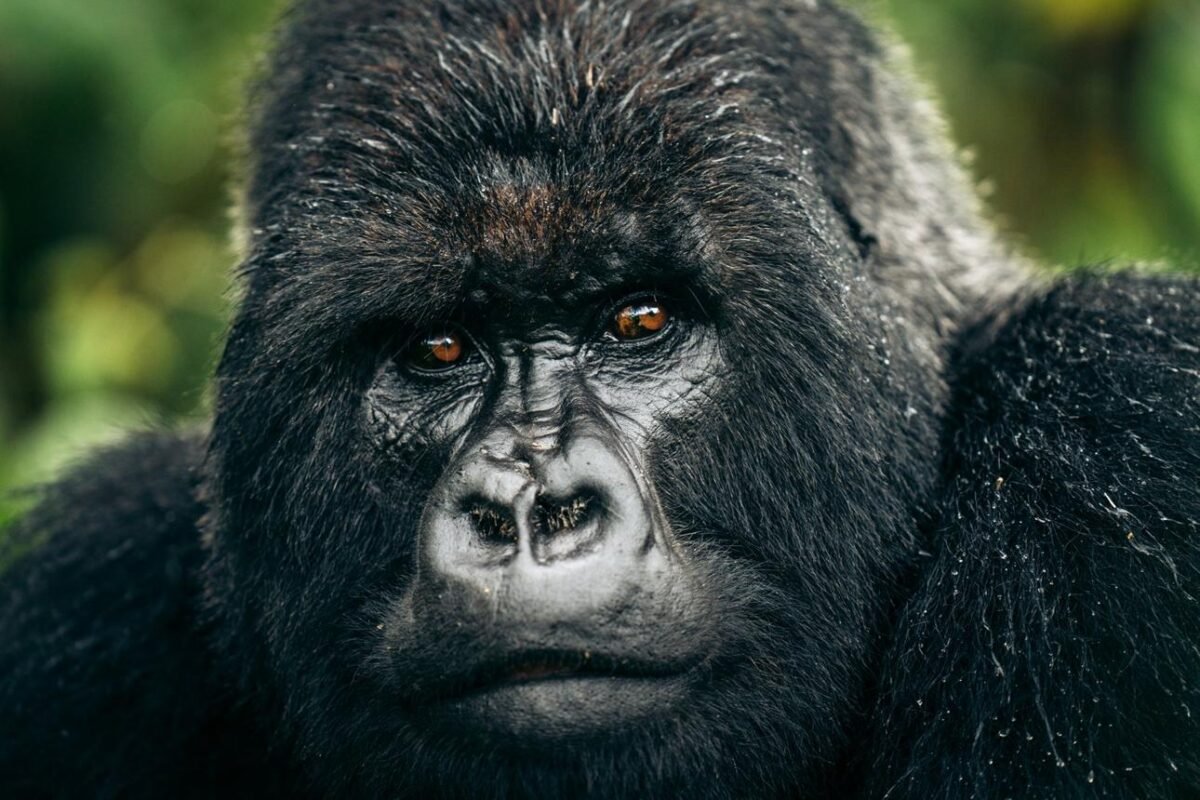
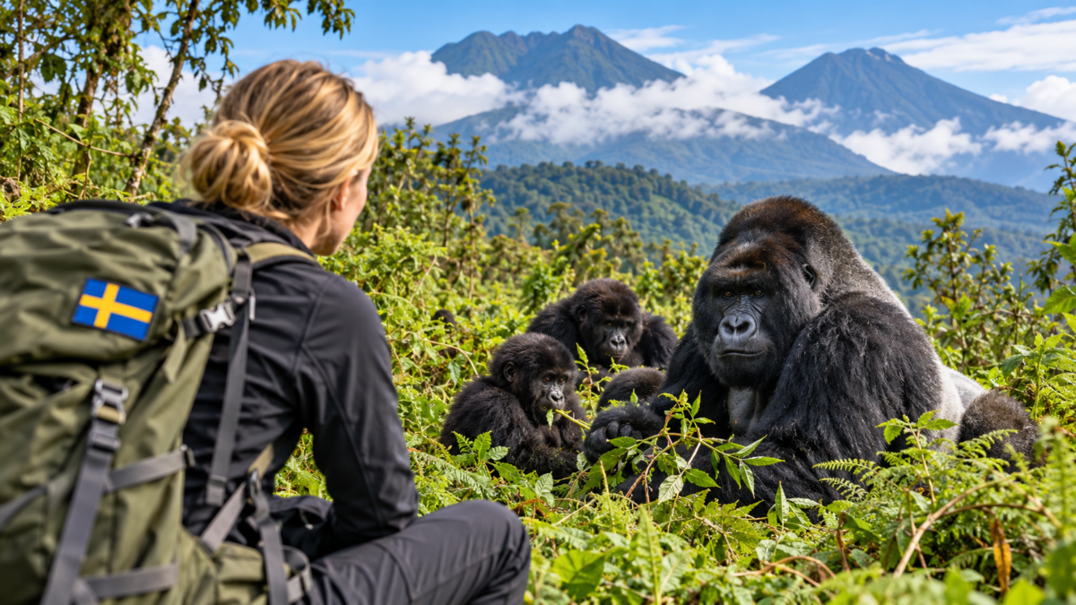
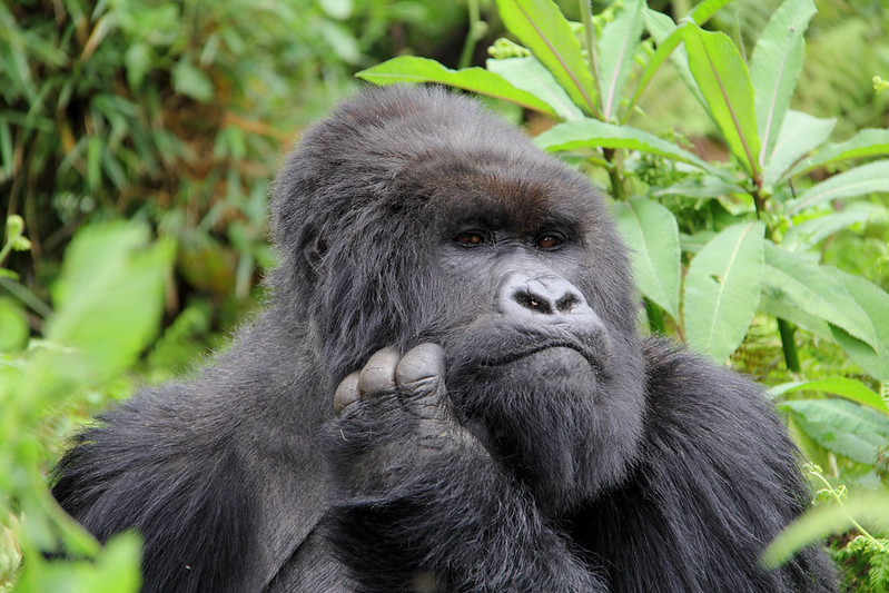
Volcanoes National Park anchors Rwanda’s reputation as a premier wildlife destination, and it sits at the foot of the same Virunga volcanoes that define the northern skyline. The park protects roughly 350 mountain gorillas spread across a dozen habituated families, and trackers guide small groups through bamboo forest and thick undergrowth each morning in search of them.
A single hour spent near a gorilla family tends to become the emotional centerpiece of an entire Rwanda trip, and travelers frequently describe the encounter as unforgettable long after they return home. The Rwanda Development Board sets the international gorilla permit at 1,500 US dollars per person, a price point that funds anti-poaching patrols, veterinary care, and community programs around the park boundary.
Zamunda Travels secures these permits well in advance for clients, since daily access is capped and demand regularly outpaces supply during the June to September and December to February dry seasons. Beyond the gorillas, the park also protects the golden monkey and preserves the former research site of primatologist Dian Fossey, whose decades of work first drew global attention to the species.
Nyungwe Forest and the Canopy Walk Above the Hills
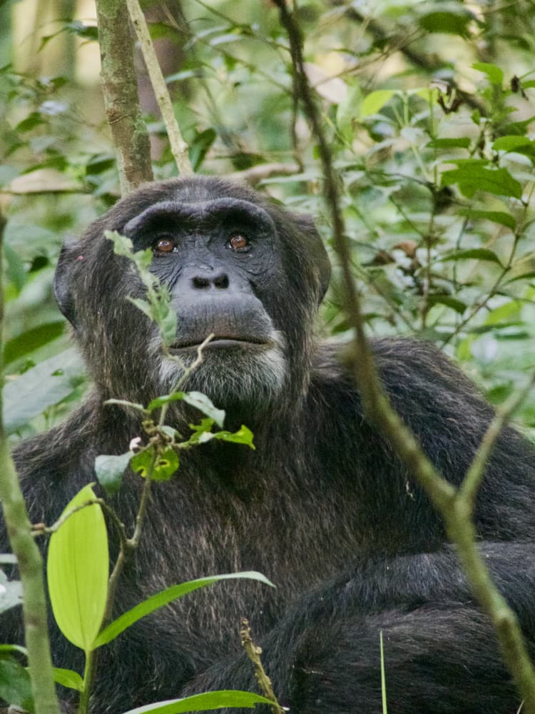
Nyungwe Forest National Park sits in the far southwest, where montane rainforest cloaks a different set of hills than the volcanic peaks up north. Thirteen primate species live within its boundaries, including chimpanzees, and researchers still document new orchid and bird species inside the reserve on a regular basis.
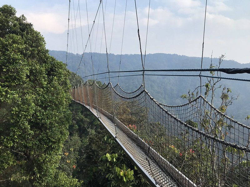
A suspended canopy walkway stretches 160 meters above the forest floor, and it gives visitors a rare aerial perspective on the endless green folds that define this part of the country. Because Nyungwe sits along the Congo Nile Divide, rain falls almost year-round, and the resulting biodiversity rivals far larger reserves elsewhere on the continent.
Zamunda Travels pairs a Nyungwe excursion with a stop at the nearby tea estates, where guests can watch pickers work the terraced slopes before sampling freshly brewed Rwandan tea. The combination of primate tracking, birdwatching, and agricultural tourism makes this region one of the most underrated stops on any Rwanda itinerary.
Lake Kivu and the Shores Along the Western Border
Lake Kivu stretches along Rwanda’s entire western frontier, and its calm, methane-rich waters create some of the most relaxed inland beaches anywhere in East Africa. Towns such as Gisenyi, Kibuye, and Cyangugu line the shore, each offering a slightly different mix of fishing culture, lakeside resorts, and volcanic scenery.
A drive from Kigali to the lake typically takes around four hours, and the route itself winds through some of the most photogenic hill country in the entire region. The Congo-Nile Trail traces the lake’s edge for roughly 227 kilometers, giving hikers, cyclists, and kayakers a multi-day route through coffee farms, fishing villages, and forest patches.
Zamunda Travels frequently closes out longer itineraries with two or three nights on Lake Kivu, since the slower pace gives travelers time to process the intensity of gorilla trekking or savannah game drives earlier in the trip. Sunset over the water, with layered hills fading into silhouette on the far shore, offers one of the calmest final images a visitor can carry home from Rwanda.
Akagera National Park and the Return of the Big Game
Akagera National Park occupies the eastern edge of the country, where the terrain drops toward swampy lowlands and the scenery shifts from hills to open savannah. Conservationists reintroduced lions in 2015 and eastern black rhinos in 2017, and the park now holds Africa’s Big Five within a single protected area again.
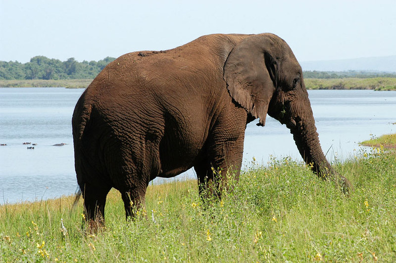
Lake Ihema anchors the park’s eastern boundary and supports large populations of hippos and Nile crocodiles, while acacia woodland further inland shelters giraffes, zebras, and elephants. Akagera demonstrates that Rwanda’s identity extends well beyond its hills, since this corner of the country trades the mountainous skyline for wide horizons and classic safari game drives.
Zamunda Travels often combines Akagera with a Kigali stopover, creating a short but complete safari experience for travelers who cannot commit to a longer gorilla trekking itinerary. The park’s remarkable recovery over the past decade also stands as one of Africa’s clearest conservation success stories.
Culture, Language, and Daily Life Across the Hills
Rwandan culture reflects the same unity that defines the landscape, since nearly the entire population shares one language, Kinyarwanda, alongside English and French as official languages. Traditional dance troupes still perform the Intore, a high-energy warrior dance passed down through generations, and travelers frequently catch a performance during a cultural village visit.
Coffee and tea remain central to daily life and to the national economy, and many farming cooperatives now welcome visitors who want to see the entire process from hillside plantation to cup. Rwanda has also become known across Africa for ambitious environmental policy, including a nationwide plastic bag ban and a monthly community service morning called Umuganda, when neighborhoods gather to clean and improve public spaces together.
Zamunda Travels arranges homestays and cooperative visits for guests who want a deeper cultural connection beyond the standard wildlife circuit, and these encounters consistently rank among the most memorable parts of a Rwanda trip.

Planning Your Trip with Zamunda Travels
Rwanda rewards travelers who plan ahead, particularly because gorilla permits sell out months in advance during peak season. The dry seasons, June through September and December through February, offer the easiest trekking conditions and the clearest mountain views, though the wetter months bring lush scenery and thinner crowds.
Zamunda Travels designs each itinerary around the traveler’s pace, whether that means a fast-moving week covering gorillas, Nyungwe, and Lake Kivu, or a slower two-week journey that adds Akagera and deeper cultural immersion. Our team handles permit bookings, park logistics, and accommodation across every budget tier, from community guesthouses to award-winning eco-lodges near Volcanoes National Park.
Because road infrastructure across Rwanda remains excellent by regional standards, Zamunda Travels can move guests between the hills, the lake, the forest, and the savannah without the long transit days common elsewhere in East Africa. Reach out to Zamunda Travels today, and let a team that knows every hillside turn this nickname into your next real adventure.