Is Mgahinga Gorilla National Park Worth Visiting?
September 28, 2026
Wildlife in Mgahinga Gorilla National Park
September 29, 2026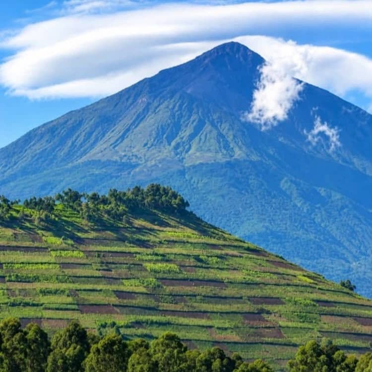
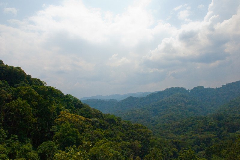
Mgahinga Gorilla National Park is one of Uganda’s most scenic protected areas. It sits in the far southwestern corner of the country, near the borders of Rwanda and the Democratic Republic of Congo. The park covers about 33.7 square kilometres, making it Uganda’s smallest national park. Despite its small size, Mgahinga offers mountain gorilla trekking, golden monkey tracking, forest walks and challenging volcano hikes. Its most striking feature is the chain of three volcanic mountains that rise above the forest: Mount Muhabura, Mount Gahinga and Mount Sabyinyo. These mountains form part of the wider Virunga volcanic range and give Mgahinga its dramatic landscape.
For travellers planning a visit, understanding the Mgahinga volcanoes adds another layer to the experience. Each mountain has its own shape, landscape and hiking character. Mount Muhabura is the highest, Mount Gahinga is the lowest of the three, while Mount Sabyinyo is famous for its rugged summit and the point where Uganda, Rwanda and the Democratic Republic of Congo meet. Zamunda Travels can help travellers combine these mountain experiences with gorilla trekking, golden monkey tracking and other activities in southwestern Uganda.
The Three Volcanoes of Mgahinga
The three volcanoes inside the park are Mount Muhabura, Mount Gahinga and Mount Sabyinyo. They are extinct volcanic mountains and form part of the Virunga Mountains, a chain of volcanoes spread across Uganda, Rwanda and the Democratic Republic of Congo. UWA describes them as three prominent conical volcanoes that dominate the park’s landscape. Their slopes contain different vegetation zones, including montane forest, bamboo and higher-altitude vegetation. The volcanic soils also support a rich variety of plants and wildlife.
The mountains are also important beyond tourism. They act as water catchments for the surrounding area, with streams flowing from the highlands. Gahinga has a crater swamp, while Muhabura has a small crater lake near its summit. The volcanic landscape has also created caves, valleys, swamps and steep slopes across the park. These features help explain why such a small protected area supports several habitats and a wide range of species.
Mount Muhabura: The Highest Volcano
Mount Muhabura is the highest of the three Mgahinga volcanoes, reaching about 4,127 metres above sea level. Its name is often associated with the idea of a guide or landmark because the mountain stands prominently above the surrounding landscape. From different points around Kisoro, its steep cone is easy to recognise. UWA identifies Muhabura as the highest peak within Mgahinga Gorilla National Park.
The hike up Mount Muhabura is demanding because of the altitude and steep terrain. The trail passes through different vegetation zones as hikers gain elevation. At the summit, hikers can find a small crater lake. The UWA management plan describes the lake as approximately 36 metres in diameter. On clear days, the summit provides impressive views across the Virunga landscape, including neighbouring volcanoes and surrounding countryside.
Because of the altitude, hikers should prepare properly before attempting Muhabura. Good physical fitness helps, but pacing is equally important. A slow and steady climb allows the body to adjust to the changing altitude. Zamunda Travels can help visitors plan the hike as part of a wider Uganda safari, while also arranging accommodation, transport and other activities around Kisoro.
What Makes Muhabura Special?
Muhabura stands out because of its height and distinctive cone. The mountain provides a completely different experience from gorilla trekking in the forest below. Instead of spending the day searching through dense vegetation for gorillas, hikers follow a steep mountain trail towards a high volcanic summit.
The crater lake adds another attraction to the climb. The landscape also changes as the trail rises, giving hikers an opportunity to see how vegetation responds to altitude. For travellers who enjoy mountain adventures, Muhabura offers one of the most challenging hiking experiences in Mgahinga.
Mount Gahinga: The Volcano That Gave Mgahinga Its Name
Mount Gahinga rises to about 3,474 metres and is the lowest of the three main volcanoes in the park. However, its importance goes far beyond its height. The name Mgahinga comes from “Gahinga,” a local word referring to piles of volcanic stones cleared from farmland. The mountain therefore has a strong connection with the landscape and communities around the park.
Gahinga also has an interesting summit feature. Its upper area contains a crater swamp. The UWA management plan describes the swamp crater as roughly 180 metres in diameter. Water retained in the high-altitude landscape contributes to the area’s important role as a water catchment.
Hiking Mount Gahinga can be a rewarding choice for visitors who want a mountain experience without taking on the highest peak. The trail still requires good fitness because the terrain can be steep and muddy, especially during wet conditions. Hikers move through forest and bamboo habitats before reaching higher areas of the mountain.
Mount Sabyinyo: The Three-Country Volcano
Mount Sabyinyo is one of the most distinctive Mgahinga volcanoes because its rugged summit sits at the meeting point of Uganda, Rwanda and the Democratic Republic of Congo. UWA’s validated 2025 park document lists the mountain at about 3,645 metres above sea level. Another UWA project document gives 3,669 metres, showing why travellers may encounter different figures in published material.
The name Sabyinyo is associated with an old man’s tooth because the mountain has a worn and jagged appearance. Unlike the smooth cone of Muhabura, Sabyinyo has several sharp ridges and peaks. The final section is especially demanding, with steep sections that require careful movement. Hikers who reach the summit are rewarded with a remarkable sense of standing above three countries.
The mountain also has ecological importance. Its slopes contain several vegetation zones, while the surrounding volcanic landscape includes valleys, swamps and steep ridges. These habitats form part of the wider Virunga ecosystem shared by Uganda, Rwanda and the Democratic Republic of Congo.
Hiking the Mgahinga Volcanoes
Hiking the Mgahinga volcanoes gives visitors an opportunity to experience the park beyond gorilla trekking. The three mountains offer different levels of challenge, so travellers should choose a hike according to their fitness, available time and interests. Muhabura is the highest and involves a demanding climb. Gahinga offers a shorter mountain experience, while Sabyinyo combines steep terrain with the unique attraction of the three-country border area.
Weather can change quickly in the Virunga highlands. Clouds, rain, mist and strong winds may appear even when conditions look good at lower elevations. Therefore, hikers should carry suitable clothing, sturdy hiking boots, water and snacks. A walking stick can also provide useful support on steep or muddy sections.
UWA has also been developing a three-peak trail in Mgahinga. Project documents describe plans for a trail connecting Muhabura, Sabyinyo and Gahinga, together with supporting infrastructure such as ladders, boardwalks, rest shelters and camping facilities. The project is intended to improve access while supporting tourism and conservation.
Wildlife Around the Volcanoes
The Mgahinga volcanoes are not isolated from the park’s wildlife. Their slopes support forests and other habitats where visitors can encounter a range of species. Mgahinga is especially important for mountain gorillas and endangered golden monkeys. UWA also lists mammals such as elephants, buffaloes, giant forest hogs and bush pigs among the park’s wildlife. The park has a bird checklist of more than 180 species, including Albertine Rift endemics.
The relationship between the mountains and wildlife is particularly clear in the bamboo and montane forest zones. These habitats provide food and shelter for many animals. Golden monkeys, for example, are closely associated with the high-altitude forests and bamboo areas of the Virunga region. Mgahinga is one of the places where visitors can see this endangered primate in its natural habitat.
The Volcanoes and Gorilla Trekking
Although mountain hiking is an important attraction, Mgahinga is best known internationally for its mountain gorillas. The park protects part of the Virunga mountain gorilla habitat and is one of only two places in Uganda where visitors can trek mountain gorillas. The other is Bwindi Impenetrable National Park. UWA states that gorilla trekking in Mgahinga normally takes between two and seven hours, depending on the location of the gorilla family and conditions in the forest.
The mountains create the environment where these forests survive. Their slopes support high-altitude habitats that connect with the larger Virunga Conservation Area. This wider ecosystem extends across Uganda, Rwanda and the Democratic Republic of Congo. As a result, a visit to Mgahinga is not simply a trip to a small national park. It is an opportunity to experience part of a much larger transboundary mountain ecosystem.
Zamunda Travels can combine gorilla trekking with volcano hiking for travellers who want a more active Mgahinga itinerary. This combination allows visitors to experience both the forest and the high volcanic landscape during the same safari.
Best Time to Explore the Mountains
The mountains can be visited throughout the year, but weather conditions affect the hiking experience. Drier periods generally provide more comfortable trail conditions, while wet weather can make volcanic slopes muddy and slippery. However, rain is possible even during the drier months because Mgahinga has a high-altitude mountain climate.
Travellers should therefore prepare for changing conditions rather than relying only on the season. A waterproof jacket, warm layers, hiking boots and a small backpack are useful throughout the year. Zamunda Travels can also advise visitors on suitable clothing and itinerary planning before travelling to Mgahinga.
Why Visit the Three Volcanoes?
The three mountains give Mgahinga Gorilla National Park a character that few other Ugandan destinations can match. Muhabura offers height and a crater lake. Gahinga combines volcanic scenery with a crater swamp and the cultural origin of the park’s name. Sabyinyo provides rugged ridges and the extraordinary experience of reaching a point where Uganda, Rwanda and the Democratic Republic of Congo meet.
For travellers interested in mountains, wildlife and photography, these peaks provide excellent opportunities to explore southwestern Uganda. They also complement gorilla trekking and golden monkey tracking. With proper preparation, a mountain hike can turn a gorilla safari into a broader adventure through one of Uganda’s most distinctive landscapes.
Plan Your Mgahinga Adventure with Zamunda Travels
The three volcanoes of Mgahinga are an important part of what makes this small Ugandan national park special. Mount Muhabura, Mount Gahinga and Mount Sabyinyo each offer a different mountain experience, while their forests and volcanic landscapes support important wildlife and water resources.
If you are planning a Uganda safari that includes Mgahinga, Zamunda Travels can help organise your gorilla trekking, volcano hiking, golden monkey tracking, accommodation and transportation. Combining these experiences allows visitors to discover both the wildlife and the dramatic volcanic landscape of southwestern Uganda.