River Nyamwamba Uganda
August 15, 2026
What Are the Nearest National Parks to Entebbe International Airport?
August 16, 2026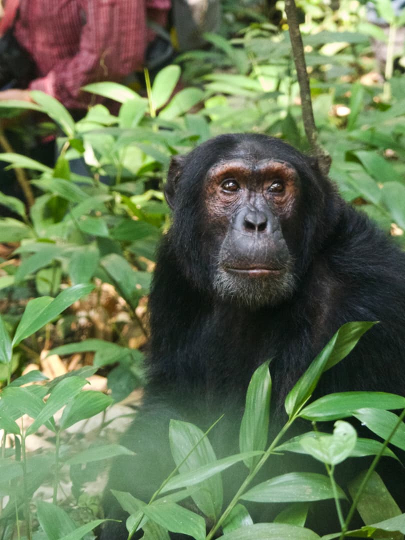
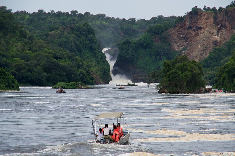
Uganda rewards travellers who move between its parks by road, and few overland legs feel as rewarding as the stretch that links the Nile at Murchison Falls with the rainforest canopy of Kibale. Anyone building a self drive itinerary or a guided safari needs a realistic picture of the Murchison Falls to Kibale drive time, because this single transfer shapes how the rest of a Western Uganda trip is planned. Zamunda Travels runs this route often enough to know exactly where the tarmac ends, where the dust begins, and where a short detour turns a long drive into a memorable day. This guide breaks the journey down honestly, distance by distance, hour by hour, so that you can plan with confidence rather than guesswork.
Understanding the Murchison Falls to Kibale Drive Time
The Murchison Falls to Kibale drive time typically runs between seven and nine hours, covering roughly 350 to 400 kilometres depending on which route your driver chooses. That range surprises many first time visitors, since a distance under 400 kilometres sounds modest on a map. Uganda’s rural roads, however, do not behave like a European motorway. Sections between Hoima and Kyenjojo still carry long stretches of murram, and rainfall can slow even an experienced driver considerably. Zamunda Travels always factors in seasonal conditions before confirming a departure time, because an accurate estimate protects the rest of your itinerary from a rushed, uncomfortable evening arrival.
Most travellers leave Paraa or the northern bank of the Nile early in the morning, since an early start avoids the worst of the midday heat and leaves a buffer for photo stops, fuel breaks, or a stretch at Masindi. A journey of this length is rarely comfortable if treated as a single non stop push, so pacing matters just as much as raw distance. Guides at Zamunda Travels typically split the drive into three natural segments: Murchison to Hoima, Hoima to Kyenjojo, and Kyenjojo to Fort Portal before the final short hop into Kibale itself.
Why the Route Takes Longer Than the Map Suggests
Google Maps often underestimates rural African driving times, and this corridor is a textbook example. The road surface changes character several times along the way, moving from smooth blacktop near Masindi to compacted gravel further south. Local truck traffic, market day congestion in small towns, and the occasional herd of cattle crossing the road all add unpredictable minutes to an otherwise straightforward drive. Drivers with Zamunda Travels build these realities into every quote, so clients rarely feel blindsided by a delay.
Weather plays an outsized role too. During the long rains of March through May, and again in October and November, murram sections between Hoima and Kyenjojo can turn slick and slow progress dramatically. A drive that takes seven hours in the dry season can stretch closer to nine or ten hours after a heavy downpour. Anyone planning a tight connecting flight or a same-day chimpanzee trekking permit should build in a generous cushion rather than cutting the schedule close.
The Standard Route: Masindi, Hoima, and Fort Portal
The most common path links Murchison Falls National Park to Masindi, continues through Hoima, and then pushes south west toward Kyenjojo before finishing at Fort Portal, the gateway town for Kibale National Park. This corridor follows the Albertine Rift escarpment, and the scenery shifts noticeably as you travel, from savannah plains near the park boundary to rolling tea estates closer to Fort Portal. Zamunda Travels favours this route for clients who want to combine practicality with genuine visual reward, since the descent toward Fort Portal offers sweeping views that few other Ugandan roads can match.
Masindi serves as a natural first stopping point, roughly an hour or two south of Paraa. The town has fuel stations, simple restaurants, and a slower pace that suits a short leg-stretch before the longer haul begins. From there, the road continues to Hoima, a regional hub with a growing number of amenities thanks to nearby oil development. Drivers with Zamunda Travels often use Hoima as a lunch stop, since restaurant options are more reliable here than along the more remote sections further south.
The Hoima to Kyenjojo Stretch
This middle section carries the greatest reputation for slow going. Long portions remain unsurfaced, and while road authorities have upgraded parts of it in recent years, other stretches still challenge even seasoned drivers. Dust replaces mud in the dry months, while the wet season brings the opposite problem of soft, rutted surfaces. Patience matters more than speed here, and a professional driver who knows the terrain intimately, such as the team at Zamunda Travels, will read the road conditions rather than fight them.
Travellers should not expect much in the way of services along this stretch, so it pays to carry water, snacks, and any medication you might need before leaving Hoima. Mobile signal also becomes patchy in places, which is worth noting if you plan to work or make calls en route. The reward for this quieter section comes gradually, as the landscape begins climbing toward the foothills of the Rwenzori Mountains and the air noticeably cools.
Arriving in Fort Portal Before Kibale
Fort Portal marks the final major waypoint before Kibale National Park, and many visitors are struck by how clean and orderly the town feels after hours on rural roads. Crater lakes dot the surrounding countryside, tea plantations stretch toward the horizon, and the Rwenzori range often appears on the western skyline when cloud cover lifts. From Fort Portal, Kibale’s park headquarters sits only a short drive away, typically under an hour depending on your specific lodge or trailhead.
Many guests choose to overnight in or near Fort Portal rather than pushing straight through to Kibale after such a long day, and Zamunda Travels frequently recommends exactly this approach. Splitting the journey preserves energy for early morning chimpanzee trekking, which demands alertness and stamina from the very first briefing at the park gate.
Alternative Ways to Manage the Murchison Falls to Kibale Drive Time
Not every traveller wants to spend a full day behind the wheel, and several alternatives exist for shortening or reshaping the Murchison Falls to Kibale drive time. Understanding these options helps you weigh cost, comfort, and scenery against each other before committing to a plan.
Splitting the Journey Overnight
Breaking the drive into two shorter days remains the most popular solution among clients travelling with Zamunda Travels. An overnight stop in Hoima or Fort Portal turns one exhausting marathon into two manageable half days, each with time left over for a proper meal, a hot shower, and genuine rest. This approach also opens the door to small detours, such as a visit to a local cultural centre or a lakeside lodge that would otherwise be skipped entirely.
Routing Through Kampala
Some drivers, particularly during the wettest months, choose to route back through Kampala rather than push directly across the Hoima to Kyenjojo stretch. This path covers more total distance but sometimes proves faster overall because it stays on well maintained tarmac for a larger share of the journey. Zamunda Travels weighs this option against seasonal road reports before every departure, since a longer but smoother route can beat a shorter but punishing one when conditions turn wet.
Chartering a Domestic Flight
For travellers with limited time or a strong preference for comfort, a short chartered flight between an airstrip near Murchison Falls and one near Kibale or Kasese can compress a nine hour drive into roughly an hour in the air. This option costs considerably more than a road transfer, yet it frees an entire day for wildlife activities rather than travel. Zamunda Travels can arrange these connections for clients whose itineraries simply cannot absorb a full day of driving.
Practical Tips for the Drive
A long transfer through rural Uganda rewards preparation, and a handful of simple habits make a genuine difference to comfort along the way. Pack layers, since temperatures shift noticeably as the road climbs toward Fort Portal. Carry cash in small denominations for fuel, snacks, or informal roadside purchases, because card payment options remain rare outside the larger towns. Confirm your fuel plan before leaving Murchison Falls, since stations thin out considerably along the middle section of the route.
Travelling with an experienced local operator changes the entire character of this drive. Zamunda Travels pairs every client with a driver guide who already knows which stretches demand caution, which towns offer a decent lunch stop, and how to adjust the schedule when weather threatens to slow progress. That local knowledge turns a demanding transfer into a genuinely enjoyable part of the safari rather than an obstacle standing between two national parks.
Final Thoughts on Planning Your Transfer
Distance alone never tells the full story on Ugandan roads, and the Murchison Falls to Kibale drive time proves that point clearly. Whether you choose the classic Hoima-Kyenjojo route, split the journey with an overnight stop, or opt for a short charter flight, success comes down to realistic planning and a driver who respects the conditions rather than fighting them. Zamunda Travels builds every itinerary around this honesty, matching pace to season and comfort to distance so that the journey between these two remarkable parks becomes part of the adventure rather than a footnote before it.